By Tom Travis
“Please don’t divide our neighborhood up. We are a strong neighborhood. Please don’t do it,” pleaded Seventh Ward and College-Cultural Neighborhood resident Chris Gardner. She was one of about 10 residents, mostly from the Seventh Ward College Cultural Neighborhood, who gathered Wednesday at Flint City Hall for an Elections Commission meeting to discuss the proposed redrawn ward map.
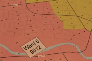
Close-up view of a large wall map of the proposed ward boundaries. The smaller numbers signify the population of particular block. (Photo by Tom Travis)
The city’s nine wards are being redrawn based on new Census 2020 data and as required by the city’s charter. At a Nov. 18 special city council meeting held in the Dome behind city hall, the public and city council members had an initial opportunity to view the map of the proposed redrawn ward boundaries and offer their input. City Attorney Angela Wheeler informed the council that evening due to the pandemic, the redrawing had been delayed.
The public can share their comments and suggestions with by mail or email. Comments can be mailed to City Clerk Inez Brown, Second Floor, 1101 South Saginaw Street, Flint MI 48502 or emailed to ibrown@cityofflint.com. No future meetings to cover this issue have been announced at this time.
9,028 is the target population for redrawn ward boundaries
Ken Koleda, director of the Genesee County Geographic Information System (GIS), has led the process of calculating and redrawing the ward boundaries based on 2020 Census data. The target population for each ward is 9,028, explained Koleda. According to a 54-page 2017 ward profile report from UM-Flint the ward populations ranged from 9,660 in Ward 3 as the lowest in population to 13,302 in Ward 8 as the highest in population.
However, to get each of the nine wards’ population within one per cent of 9,028, the boundaries must be redrawn. The recent 2020 Census reported that Flint lost 20,000 in population over the last ten years, plummeting to 81,000. This is a 21 per cent decrease and the lowest population for Flint since the 1910 census.
Flint’s Elections Commission is made of City Clerk Inez Brown, City Assessor Stacey Kaake and Assistant City Attorney JoAnne Gurley. The Elections Commission along with Ken Koleda, director of the Genesee County Geographic Information System (GIS) was present at Wednesday’s meeting. Koleda, once again, presented the proposed Ward boundary map.
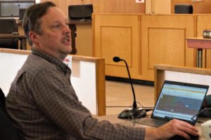
Ken Koleda, director of the Genesee County Geographic Information System (GIS) seated at his laptop guiding residents through the statistics and ward map presentation at Wednesday’s Elections Commission meeting. (Photo by Tom Travis)
President of College-Cultural Neighborhood Association calls for the proposed map to be redrawn
Mike Keeler, a Seventh Ward resident and president of the College-Cultural Neighborhood Association (CCNA), said, “The CCNA has 1,300 households and we are a strong neighborhood association. Based on phone calls and from viewing posts on Facebook, we are 100 per cent against this map. It basically splits our neighborhood in half.
“Our neighborhood is 103 years old,” Keeler said. “It’s never been split in half and we’re not going to stand for it now. It disenfranchises us and weakens us politically.”
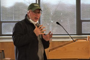
College-Cultural Neighborhood Association President Mike Keeler speaks at Wednesday’s meeting pleading with the commission to “redraw” the ward boundary map asking for neighborhoods to not be “split”. (Photo by Tom Travis)
Keeler called for the southern border of the seventh ward, I-69, to remain as it is now. In the redrawn map the seventh ward the southern border of the ward is extended down below (south) of I-69. Keeler said the Independent Commission [Michigan Independent Citizens Redistricting Commission] recommends to cities when redrawing ward boundaries they should not split or divide neighborhoods.
Keeler suggested to the Elections Commission that the map be redrawn, pointing out that one of the standards of the MICRC in redistricting is to “not break up neighborhoods.”
“We’ve been working since 1992 gathering emails and phone numbers and building a community. Our neighborhood wants to remain whole,” Keeler pleaded He mentioned there are a hundred different ways to draw the maps.
After the meeting, EVM asked Koleda if he was willing to redraw the map. He pointed out that he will take requests from the Elections Commission for redrawing the map.
City Clerk Inez Brown said that this is only the first draft map. Nothing on the map has been approved by city council yet, she emphasized.
Seventh Ward resident points to concept of “communities of interest”
Another Seventh Ward and CCN resident, Larry Anderson, prefaced his comments by saying his thoughts were more “philosophical.” Anderson said that the state MICRC uses “communities of interest” as one of their guiding principles.
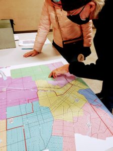
Residents examine a large version of the proposed ward boundary map after the Elections Commission meeting. (Photo by Tom Travis)
He explained that “communities of interest” are geographical areas which share common interests and wish to be perceived as a voting block. And as much as possible those redrawing boundary maps respect the input they get from citizens as to how they identify their communities of interest.
Suggestion: Wait eight years, adjust charter
Mark Baldwin, a Third Ward resident, suggested to take the next eight years and make adjustments to the charter, get zoning in place and “start to get Flint on a foundation that can be built on.” Baldwin said, “then at the next census [2030] we take a serious look at how to adjust the ward boundaries.”
Returning to his seat, Baldwin added that he thinks the charter should be adjusted to decrease the number of Flint wards from nine to seven. City Clerk Brown noted that it takes about a year to change any part of the charter because the State becomes involved.
Flint Neighborhood map available from Flint Neighborhoods United
Joel Arnold, Seventh Ward and Central Park Neighborhood resident and also the Planning and Advocacy Coordinator at Communities First, Inc. acknowledged the difficulty of putting together the ward maps and knowing where the neighborhood boundaries are located. Arnold suggested the Elections Commission and GIS look at a neighborhood map that Flint Neighborhoods United has developed.
Councilpersons Herkenroder and Pfeiffer call for “listening to residents”
Two council members were present for the Elections Commission meeting, Councilpersons Dennis Pfeiffer (Ward 8) and Allie Herkenroder (Ward 7). Pfeiffer said he had examined the maps and realizes he will lose 20 per cent of his constituency with the present proposed map adding, “There’s no way around that.”
Pfeiffer told the commission he would “encourage this body to listen to residents. We are already a divided city, and it is important that these folks are heard and that communities stay together as much as possible.”
Councilperson Allie Herkenroder (Ward 7) acknowledged most of the residents attending the meeting were from her ward and the CCN. She noted her own house will remain in the Seventh Ward by only a few hundred feet, according to the proposed redrawn ward boundary map. Herkenroder called for the commission “to work in tandem with the residents to make sure our neighborhoods are not divided.”
Redrawing “an opportunity to start fresh”
Paul Herring, Fifth Ward and Carriage Town Historical Neighborhood resident, said, ” I look at this differently. This is an opportunity to start fresh in Flint. We had nine wards when we had 200,000 people. We’re well under 100,000 now. We need to consolidate.”
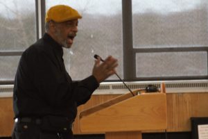
Carriage Town Historic Neighborhood resident Paul Herring suggests his idea of dividing the city into five wards at Wednesday’s meeting. (Photo by Tom Travis)
Herring suggested an alternative way of drawing the ward boundaries by “laying a coin on a map over the downtown area and from there drawing five pie wedges to draw the ward boundaries making each of the five ward councilpersons responsible for the downtown area.”
Herring argued that he didn’t see the new ward boundaries affecting these organizations [the established Flint neighborhoods]. He added that the neighborhoods which are “historically strong will still exist. The lines on the map don’t have to stop them from doing what they do. Neighborhoods that are strong will stay together.Elections Commission member Stacey Kaake, who’s also The City of Flint assessor, raised the point that with the present ward map having the CCN split in half, “wouldn’t it be better to have two voices on council than one?”
CCNA President Keeler rose out of his seat to respond, “The way they drew the ward boundaries the neighborhood would be in Ward Four and Ward Seven. I don’t think our current representative would have a shot at winning the Seventh Ward so we’d end up losing that.”
“Then we’d be such a fringe of the Fourth we probably wouldn’t be listened to anyway. It’d be much better to have all of us together so we can have one voice when there’s a problem rather than half of the neighborhood have a voice.”
Link to the map of the present ward boundaries.EVM Managing Editor Tom Travis can be reached at tomntravis@gmail.com.


You must be logged in to post a comment.